Antarctic Iceberg Tracker
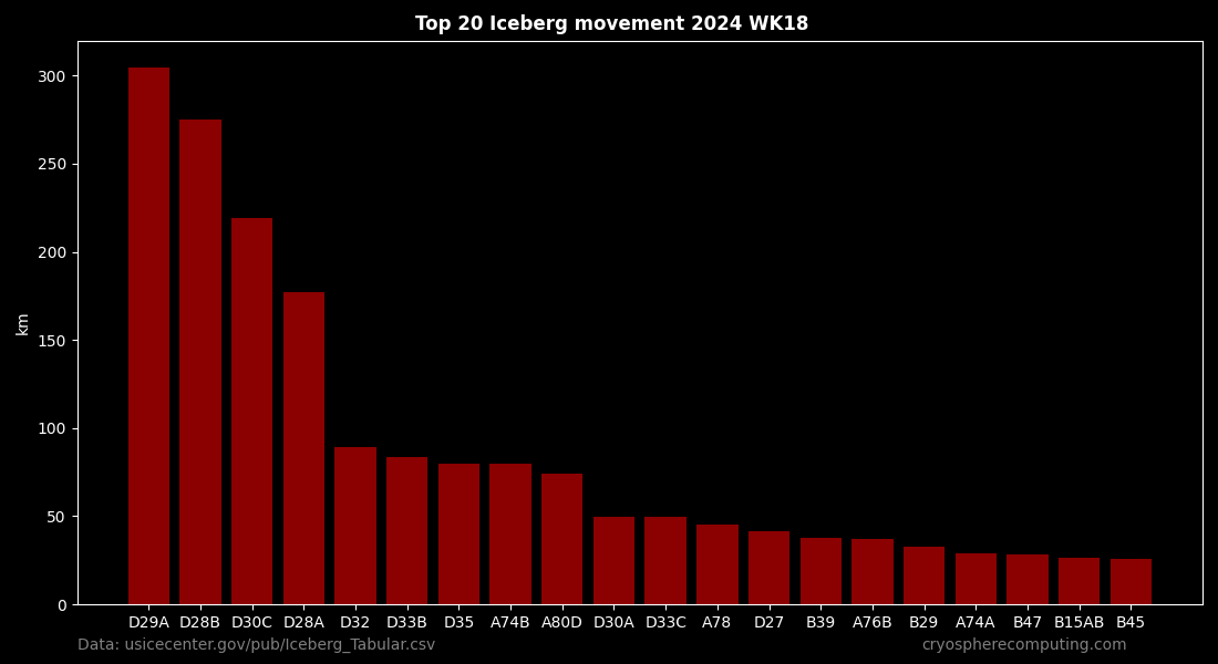
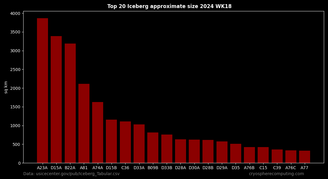
Iceberg locations, speed and size updated every Saturday
| Iceberg | Lat | Lon | Length | Width | Area (approx) |
|---|
About Antarctic Iceberg Monitoring
This dashboard provides real-time tracking of Antarctic icebergs, leveraging authoritative data from the U.S. National Ice Center (NIC). Researchers, maritime operators, and climate scientists use this interactive chart to monitor drift patterns, iceberg sizes, and potential navigation hazards in Southern Ocean shipping routes.
Data Methodology & Updates
Our tracking system visualizes locations derived from satellite imagery processed by the NIC. Data is refreshed every Saturday to ensure accuracy regarding iceberg movement and calving events. The table below allows users to sort specific icebergs by latitude, longitude, length, width, and approximate area.
Data Source: U.S. National Ice Center (NIC) via Iceberg_Tabular.csv